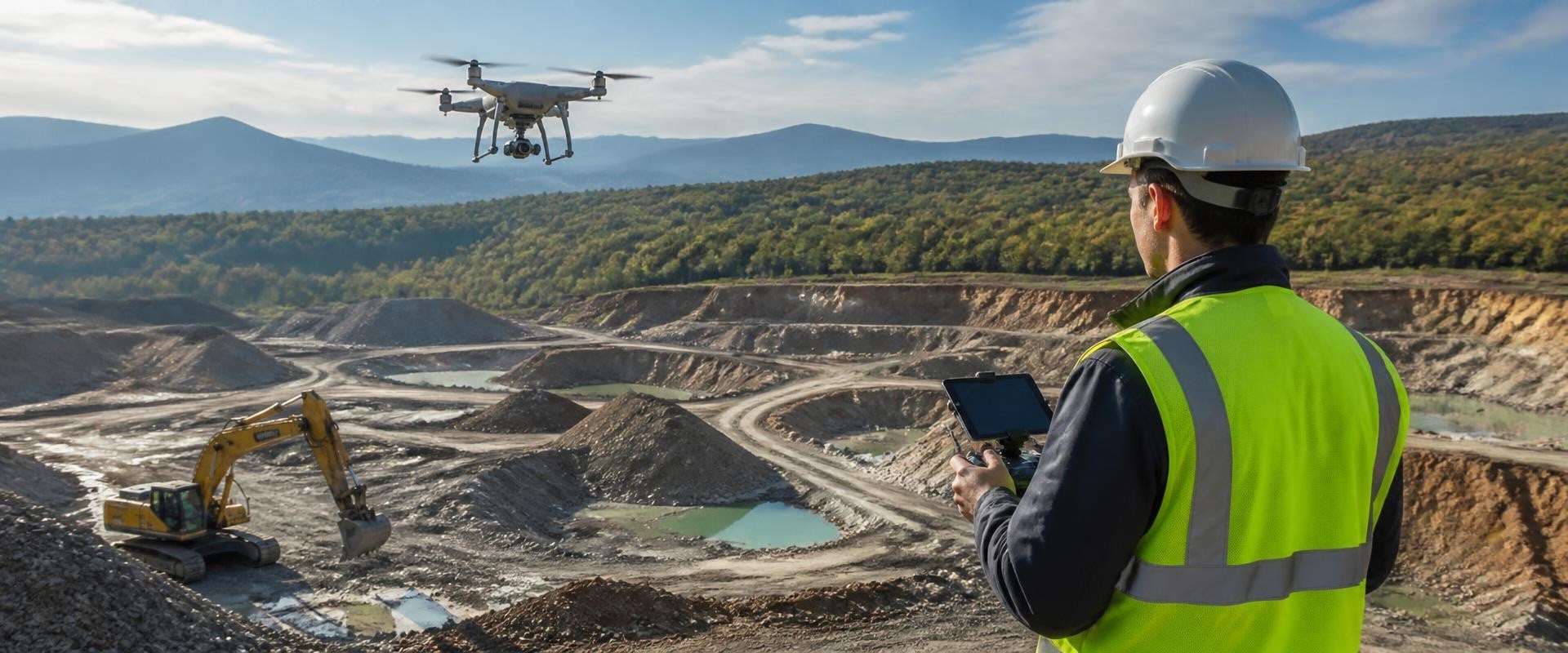
In recent years, Drones for site surveyingDrones for site surveying have emerged as a groundbreaking technology, transforming the landscape of the construction industry. At San Diego Contractor News, we delve into the innovative uses of drones, highlighting how they enhance efficiency and accuracy in site surveying. As the demand for precision in construction projects grows, the integration of drone technology is not just a trend; it is becoming an essential component for contractors and builders alike. From capturing high-resolution aerial imagery to mapping topographical features, drones are revolutionizing traditional surveying methods. Their ability to quickly gather data across expansive areas minimizes labor costs and reduces project timelines, providing significant advantages to those in the field.
In this article, we will explore how these advancements are shaping the future of site surveying, making it more accessible and efficient for professionals in San Diego and beyond. The landscape of construction is evolving rapidly, with drones for site surveying emerging as a crucial tool in enhancing efficiency and accuracy. As highlighted by San Diego Contractor News, the integration of drone technology into the construction sector is not merely a trend; it represents a significant shift in how projects are planned and executed. Drones offer numerous advancements that make them ideal for site surveying, including high-resolution aerial imagery, LiDAR capabilities, and advanced GPS technology, which collectively contribute to precise data collection. Drones are revolutionizing the way mapping and 3D modeling are conducted in construction. With the ability to cover vast areas in a fraction of the time it takes traditional methods, drones can create detailed topographic maps that are essential for initial project planning.
Their capability to capture thousands of images from various angles allows for the development of accurate 3D models that provide stakeholders with a comprehensive view of the project site. For example, in San Diego, several construction firms have utilized drones to survey large parcels of land, enabling them to assess terrain features and existing structures before breaking ground. Additionally, drones play a pivotal role in monitoring construction progress. By conducting regular aerial surveys, project managers can track advancements against timelines and budgets, ensuring that any discrepancies can be addressed promptly. This proactive approach not only helps in maintaining workflow but also minimizes potential delays that could arise from unforeseen issues on-site. However, with the rise of drone usage comes the necessity to adhere to regulations governing their operation.
In the United States, the Federal Aviation Administration (FAA) has established guidelines that contractors must follow when incorporating drones into their workflow. These regulations include obtaining necessary permits and ensuring that drone pilots are certified. Understanding these rules is crucial for contractors and homeowners alike, as non-compliance can lead to significant penalties or project delays.
San Diego Contractor News
offers insights into these regulations and how they impact local builders and property owners seeking to utilize drone technology. Despite their many benefits, there are common concerns surrounding the use of drones in construction.Privacy issues often arise when drones are deployed near residential areas, leading many to question whether their personal space is being invaded. Additionally, safety regulations must be considered; drone operators must ensure that flights do not pose risks to people or property below. Addressing these misconceptions is essential for fostering a positive perception of drone technology within the community. Moreover, one of the most compelling advantages of using drones for surveying is their ability to collect vast amounts of data efficiently. This data is invaluable in streamlining project planning and execution phases, as it allows for better forecasting and resource allocation.
By leveraging this information, contractors can make informed decisions that enhance overall project outcomes. In conclusion, the adoption of drones for site surveying marks a significant advancement in construction practices. As they continue to gain traction within the industry, understanding their capabilities, regulatory requirements, and potential impacts will be vital for those looking to capitalize on this technological trend.
Case Studies: Drones in Action
In recent years, the integration of drones for site surveying has revolutionized the construction landscape in San Diego. Numerous projects have successfully harnessed this technology, showcasing its potential to enhance accuracy and efficiency in surveying processes. For instance, a prominent residential development in the heart of San Diego utilized drones to conduct topographic surveys.By employing drone technology, the project team was able to gather comprehensive data in a fraction of the time it would have taken using traditional methods. This not only expedited the planning phase but also minimized disruptions to the surrounding community. Another notable example can be found in a commercial building project where drones were deployed to assess land conditions and monitor construction progress. The aerial imagery captured provided real-time insights that facilitated better decision-making among project managers. Such implementations highlight the growing importance of drones for site surveying in improving workflow and ensuring project timelines are met. According to San Diego Contractor News, these advancements in drone technology are not only transforming how surveying is conducted but are also influencing industry trends.
The publication consistently provides valuable insights into how such technologies are being adopted within local projects, offering a glimpse into the future of construction in San Diego. As more contractors recognize the benefits of using drones, we can expect to see an increase in their application across various types of projects. This shift is indicative of a broader trend within the construction industry, where innovation continues to drive efficiency and improve outcomes.
Benefits of Drones for Site Surveying
Drones are revolutionizing the way site surveys are conducted, offering numerous advantages that significantly enhance efficiency, reduce costs, and improve accuracy in the construction industry. As highlighted by San Diego Contractor News, the integration of drone technology into site surveying is becoming increasingly essential for contractors and builders looking to stay ahead in a competitive market. One of the primary benefits of using drones for site surveying is their ability to improve efficiency. Traditional surveying methods can be time-consuming, often requiring teams of workers to manually measure and document site conditions.In contrast, drones can quickly capture aerial imagery and gather data over large areas in a fraction of the time. This rapid data collection allows project teams to focus on analysis and decision-making rather than spending extensive hours on the ground. Additionally, drones contribute to significant cost reductions in surveying projects. By minimizing the need for expensive equipment and reducing labor costs associated with traditional methods, drones can help contractors save money on both small and large-scale projects. The efficiency gains translate into shorter project timelines, which further enhances cost-effectiveness. Moreover, the accuracy of data collected by drones is unparalleled.
Equipped with high-resolution cameras and advanced sensor technology, drones can produce detailed maps and 3D models that are far more precise than those generated through manual surveying. This increased accuracy not only aids in project planning but also helps mitigate risks associated with miscalculations or oversights during construction. According to San Diego Contractor News, these improvements in data accuracy have led to better compliance with regulations and enhanced project outcomes. In summary, the adoption of drone technology in site surveying offers substantial benefits, including improved efficiency, reduced costs, and enhanced accuracy. As the construction industry continues to evolve, staying informed about these technological advancements is crucial for professionals looking to leverage innovative solutions for their projects.
Regulations Surrounding Drone Usage
The use of drones in site surveying is revolutionizing the construction industry, but it also comes with a set of regulations that contractors must navigate.In San Diego, as well as across the United States, the Federal Aviation Administration (FAA) has established guidelines that govern the commercial use of drones. These regulations are designed to ensure safety in the airspace and to protect both individuals and property on the ground. For contractors looking to utilize drone technology for surveying, understanding these regulations is crucial. In San Diego, contractors must comply with local ordinances in addition to federal regulations. This includes obtaining a Remote Pilot Certificate from the FAA, which requires passing an aeronautical knowledge test.
Furthermore, drone operators must adhere to specific operational limitations, such as flying below 400 feet and maintaining visual line-of-sight with the drone at all times. It is also essential for contractors to be aware of no-fly zones, which may include areas near airports, military installations, and certain public spaces. San Diego Contractor News provides valuable insights into these evolving regulations, helping contractors stay updated on any changes that may affect their operations. By staying informed about both local and federal guidelines, contractors can effectively incorporate drones into their surveying processes while ensuring compliance and safety. In addition to federal regulations, contractors should also be aware of any state-specific laws regarding privacy and data collection when using drones. This is particularly important when capturing images or videos of private properties or individuals without consent.
Failure to comply with these regulations can result in legal repercussions and damage a contractor's reputation. As the technology surrounding drones continues to advance, so too will the regulatory landscape. Contractors in San Diego must remain vigilant and proactive in understanding these regulations to fully leverage the benefits of drone technology in site surveying.
The Technology Behind Drones
The realm of drones for site surveying has evolved significantly with advancements in technology, making them indispensable tools in the construction industry. According to San Diego Contractor News, these aerial devices are not just a novelty but are becoming standard equipment for modern surveying tasks. The technical specifications of drones used in surveying are crucial to understanding their effectiveness and efficiency. One of the primary components that define a drone's capability in site surveying is its camera system.Most surveying drones are equipped with high-resolution cameras that can capture detailed images and videos from the sky. These cameras often include RGB cameras for standard imaging and multispectral cameras that can analyze various wavelengths of light, providing valuable data for assessing vegetation health, soil conditions, and more. In addition to cameras, many drones utilize LIDAR (Light Detection and Ranging) systems. LIDAR technology allows drones to create precise 3D models of the terrain by emitting laser beams and measuring the time it takes for the light to return after hitting the ground. This data is essential for creating accurate topographical maps and understanding site elevations. Another significant aspect is the integration of various sensors that enhance a drone's surveying capabilities.
These can include GPS sensors for precise location tracking, for stability during flight, and thermal sensors for detecting heat differences in the landscape. The combination of these technologies helps ensure that the data collected is both accurate and reliable. As highlighted by San Diego Contractor News, understanding these technological components is crucial for contractors looking to leverage drones in their surveying processes. With the right equipment, professionals can achieve greater accuracy and efficiency than traditional methods, significantly streamlining their operations. In conclusion, the integration of drones for site surveying has significantly transformed the construction industry, particularly in San Diego. As we explored, the technology behind drones enables unparalleled accuracy and efficiency, making them indispensable tools for contractors and surveyors alike.
The benefits of utilizing drones in site surveying are clear, from enhancing data collection to streamlining project workflows. Moreover, it is crucial for industry professionals to stay informed about the evolving landscape of drone technology and the regulatory frameworks governing their use. Resources like San Diego Contractor News provide valuable insights into these developments, ensuring that builders and contractors remain compliant and competitive in their projects. By leveraging the information available through such platforms, stakeholders can effectively harness the advantages of drones while navigating the complexities of regulations and trends.